Mr. Head's 6th Grade Classroom
Absolute Location
How do we know where we are in the world? A presentation for middle schoolers explains absolute location and other geography terms such as relative location. It also gives scholars the opportunity to practice finding absolute location on...
Curated OER
Designing a Hiking Trail
Put your students' map skills to the test with this engaging cross-curricular project. Given the task of developing new hiking trails for their local community, young cartographers must map out beginner and intermediate...
Curated OER
Climate Shifts
Eight slides of information related to shifts in the climate make up this presentation. The vocabulary and concepts displayed are geared toward high school meteorology learners. Content is not cohesive from slide to slide, but the...
Curated OER
Global History & Geography: Latin America
The instructions say to use a text-book to label 11 different regions in modern Latin America. If a text-book is not available a map can be found on-line and printed for student reference.
Curated OER
What You Can Learn From a Map
Students discover how to interpret maps. In this geography skills lesson, students explore geographic themes as they complete worksheet activities regarding road maps, shaded relief maps, and topographic maps.
Curated OER
Physical World Map
In this world map worksheet, learners practice their geography skills as they label the 7 continents and 5 oceans. Teachers may use this physical map for various classroom activities
Study Stack
Geography Crossword Puzzle 2
In this online interactive geography crossword puzzle instructional activity, students use the 5 clues to find the appropriate answers to complete the word puzzle.
Curated OER
Mural Mania
Students research and discuss symbols and features of their state. They create a mural representing their state and design a quarter for their state.
Curated OER
Describing Another's Physical Features
Students practice describing someone using their physical characteristics and others try to select the person they are describing.
Curated OER
Let's Make a Map
Second graders draw maps of their playground, noting objects such as trees and play equipment. Working in groups, they make maps of different parts of the school and assemble them into a schoolwide map. They make maps on a field trip to...
Houghton Mifflin Harcourt
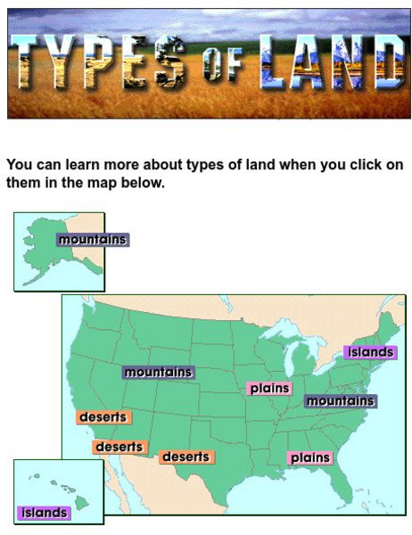
Harcourt: School Publishers: Types of Land
This clickable map of the United States defines different geographic features such as mountains, plains, islands, and deserts.


