University of Texas at Austin
The Perry Castaneda Library Map Collection
This collection contains more than 250,000 maps covering all areas of the world, and ranging from political and shaded relief maps to the detailed and the historical. Select from a region of the world or an area of highlighted interest.
Houghton Mifflin Harcourt
Harcourt: School Publishers: Types of Land
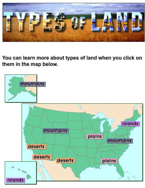
This clickable map of the United States defines different geographic features such as mountains, plains, islands, and deserts.
University of Texas at Austin
Perry Castaneda Library Map Collection: u.s. Maps
At this site find any type of map on the U.S. and any of its states here. Great site for teachers to print out maps to use in the classroom.
ABCya
Ab Cya: Geography Practice: Usa Puzzle Map
Assemble a puzzle of the United States to test your knowledge of its geography.


